FAR EAST FLANEUR
Illustrated Map
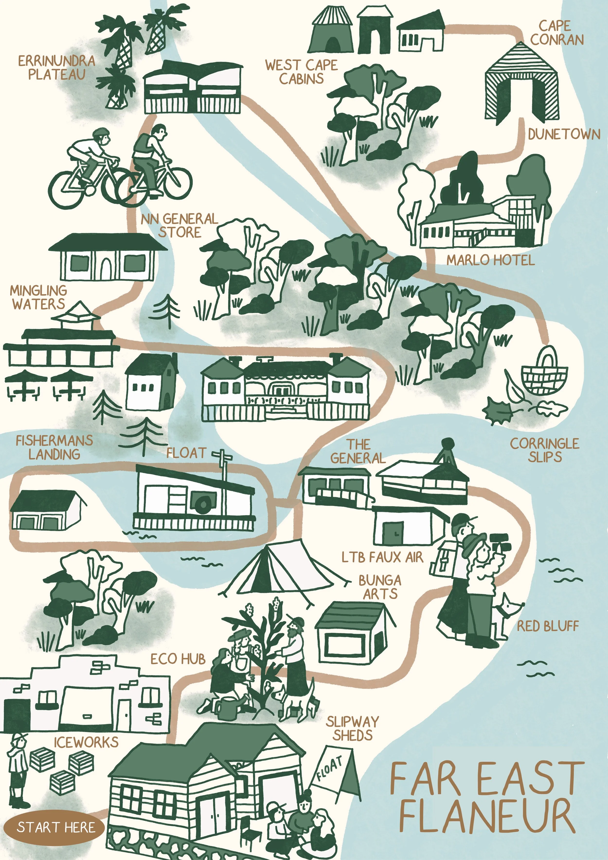
Illustrated map of Far East Gippsland commissioned by FLOAT, showcasing the region’s towns, coastlines and natural landmarks. The map was designed to support a walk called ‘Far East Flaneur’, a multi day hike through the region.